GPS project: field test
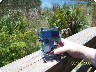
I got a chance to field test the GPS unit yesterday. Overall I’m quite happy with how things went. Even though it’s quite large for a GPS unit, the box fits nicely into my small pack, and everything functioned fairly well during the hike.
I can already see that the buttons need to be recessed somehow. I opened my pack a couple of times to check on things, and the backlight was on each time. This means that the buttons are being hit as the unit moves around in my pack. On a short hike this was ok, but on a long one it would drain the battery much faster.
One thing that I wasn’t prepared for is the fact that my phone is very hard to see clearly in direct sunlight (which we were in during the entire hike!), and impossible to photograph under any conditions (it’s like a mirror).
Even with those problems, Google Maps was very accurate with the GPS data that the unit was feeding it, and since I had a cell signal I had satellite imagery during the hike. The GPS data from the hike is pretty good, although I am going to have to use some averaging or filtering to clean the data up a bit. I have a map with the raw data here, and you can see that when we take a break the data points tend to “wander around”. I think that it’s time to get to know GPSBabel.

